We believe that KDS will offer you the best solution for the exercise at hand
We use our state of the art UAV (Drone) technology to complete your survey requirements. Unlike manned aircraft, our UAVs are available at a moment’s notice and since transport is easy it can be on site quickly without having to first obtain permissions and flight clearance; additionally nearby airports/landing strip are not required. Another advantage is that we use autonomous flight control giving us the ability to save the flight plan to be used again at a later date and thus insuring that the survey covers the EXACT same area each and every time, which a piloted aircraft cannot offer.
Our UAVs are highly sophisticated and able to fly at speeds of 40 – 90 km/h, depending on the prevailing winds, and single flight times of close to an hour, giving us the ability to cover up to 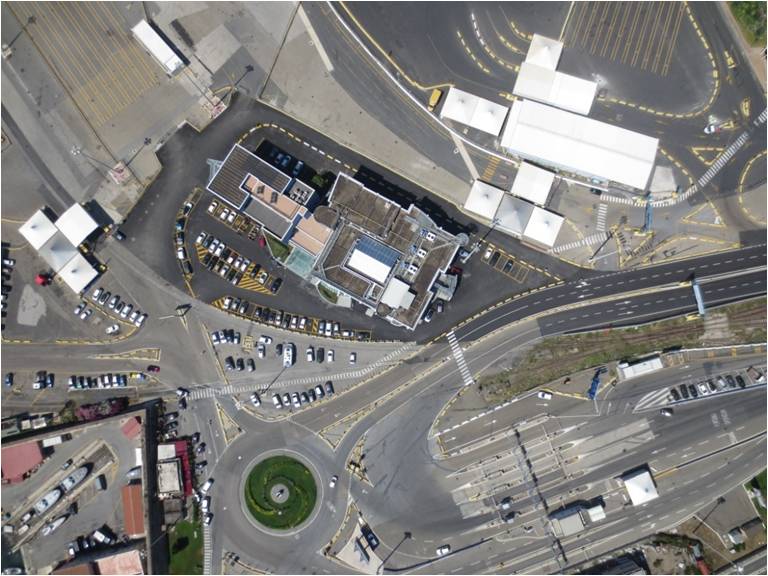 10km2 in a single flight. The UAV is powered by an electric propeller and thus has an almost zero carbon footprint; additionally it is practically silent to the environment below thus not causing any disturbances to animals or people in the surveying area. We offer a ground sampling distance (GSD) of 30cm when flying at 974m above ground, which should be more than sufficient for most projects and if more detail is required we are able to offer a GSD of 2cm, which is about the size of a matchbox.
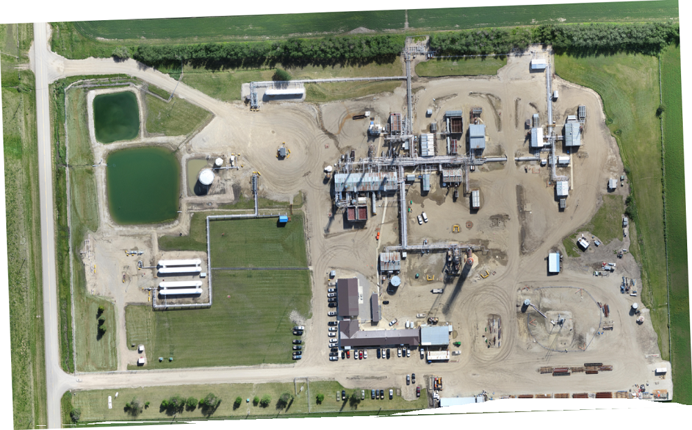
Once the flights are completed we download the images captured, which are all geo-referenced, and process them using our post flight data software. Once everything is processed we are able to supply 2D orthomosaics and 3D maps of which all can be exported to GIS platform if required.